
Coastal Ocean Monitoring Center, National Cheng Kung University (COMC, NCKU)
Marine Meteorological Data Buoy
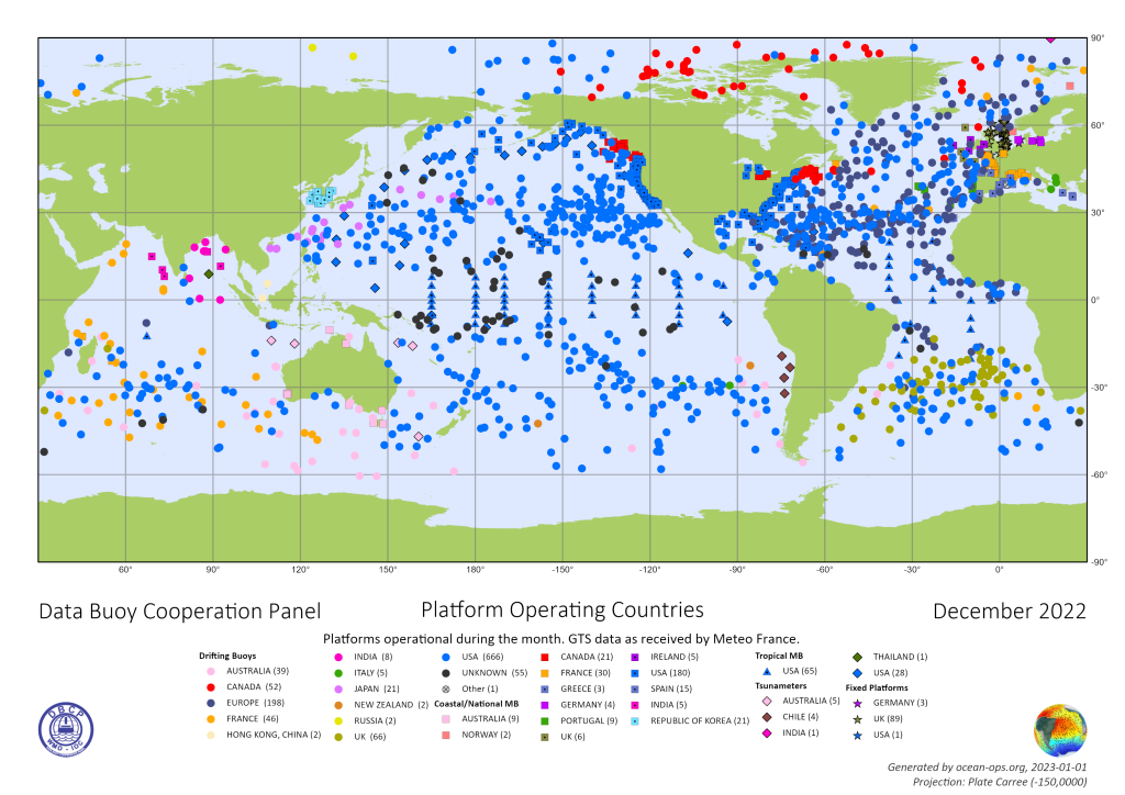
Marine meteorological data buoys serve as sentinels at sea, continuously monitoring oceanic and meteorological conditions around the clock. According to global statistics, there are about 500 moored data buoys worldwide that operationally collect marine environmental data. These buoys are extensively used internationally to support weather forecasting, typhoon early warnings, maritime search and rescue, and fisheries operations.
In Taiwan, long-term operational data buoys are equipped to record parameters such as air pressure, air temperature, wind direction and speed, water temperature, wave height, wave period, and wave direction. The buoy hull is made of aluminum alloy and protected by energy-absorbing fenders, providing sufficient resistance against impacts and harsh sea conditions. Because the discus-shaped buoy effectively responds to wave motion at the sea surface, it is used as the main platform for wave observations. Wave measurements are obtained by simultaneously recording the buoy’s acceleration, pitch, and roll motions, from which wave height, period, and direction are calculated.
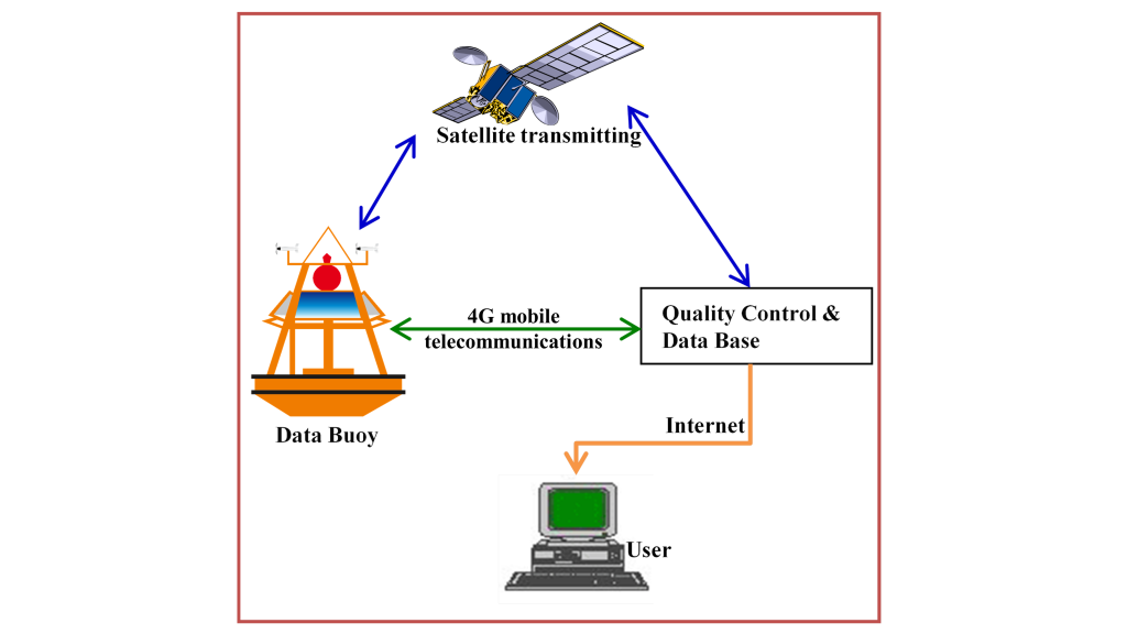
Before the 1990s, the development of wireless communication technology was limited, and most marine observation systems lacked the ability to transmit data in real time. Observation data were stored locally and periodically retrieved, which, while valuable for engineering design and scientific research, could not meet the time-critical demands of weather forecasting and disaster early warning. Both meteorological forecasting and disaster prevention are essentially races against time — every minute gained in acquiring real-time data from the field can help reduce loss of life and property. With continuous advances in wireless communication technology, real-time ocean and meteorological data can now be instantly integrated into forecasting models. To ensure reliable data delivery even under extreme marine conditions, Taiwan has successfully developed and integrated multi-channel real-time data transmission technologies, including 4G and satellite communication systems, into its observation network. These systems enable each dataset to be transmitted within minutes after measurement, allowing the onshore monitoring center to collect real-time data from observation stations around Taiwan within 15 minutes.
Taiwan’s marine data buoy observation operations have been conducted for over 20 years, accumulating a massive volume of data that has been practically applied across multiple fields, including:
- Maritime Traffic Safety: 7 data buoys are deployed around Taiwan’s offshore islands — including Guishandao, Xiao Liuqiu, Matsu, Lanyu, Pengjiayu, Kinmen, and Penghu — serving as essential references for vessel navigation between the main island and the offshore islands.
- Fisheries Operations: Data buoys deployed around Taiwan’s coastal waters provide comprehensive marine meteorological information supporting fishing activities across more than 20 fishing ports, enhancing operational safety and efficiency.
- Renewable Energy Assessment: Observational data from buoys are used to assess offshore wind farm sites, helping developers evaluate marine meteorological conditions and plan turbine layouts and construction strategies. Offshore wind energy companies rely on buoy data for site assessment and design optimization.
- Coastal Disaster Early Warning: Taiwan lies along major typhoon tracks, and during each typhoon event, the government establishes an emergency response team that continuously analyzes real-time buoy data to assess and forecast potential coastal hazards.
- Marine Recreation Planning: At least 6 data buoys are located near coastal recreation areas, providing real-time sea condition data that support the planning and safety management of marine recreational activities.