
Coastal Ocean Monitoring Center, National Cheng Kung University (COMC, NCKU)
Wave
Ocean waves are generally classified into two main types: wind waves and swell. The saying “no wind, no waves” reflects the fact that most ocean waves are generated by wind forcing. Waves formed by local winds are referred to as wind waves. In contrast, the phrase “three-foot waves even without wind” describes swell, which originates from distant storm systems or remains after local winds have weakened or changed direction. Beyond their different origins, wind waves and swell also differ in their physical characteristics. Wind waves typically have a steep and irregular appearance, with relatively short wavelengths and periods. Swell, on the other hand, undergoes energy dissipation during propagation due to air resistance and internal water friction. This results in a reduction in wave height and an increase in wave period and wavelength. Consequently, swell appears smoother and more regular, with longer periods and wavelengths that can reach several hundred meters. Moreover, swell propagates much faster than the movement of weather systems. Swell generated by typhoons or southwest monsoon often serves as a precursor signal of approaching weather systems.
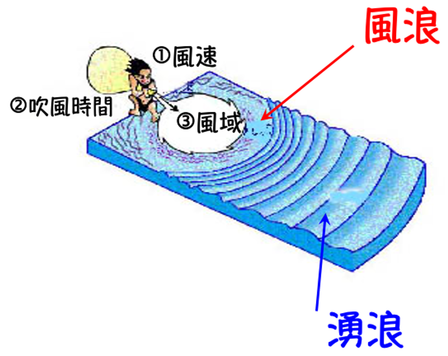
Schematic Diagram of Wave Generation Factors
In addition, Francis Beaufort, an admiral of the British Navy, established the first wind force classification system in 1805 based on extensive maritime observations. The relationship between wind speed and wave height defined on this scale can be used to estimate sea conditions in open-ocean environments. The Beaufort wind force scale and corresponding sea state scale are presented in the table below.
| Beaufort scale | Sea State | Wind Speed | Wave Height | ||
|---|---|---|---|---|---|
| knots | m/s | typical | max | ||
| 0 | – | <1 | 0-0.2 | m | m |
| 1 | light ripples | 1-3 | 0.3-1.5 | 0.1 | 0.1 |
| 2 | light ripples | 4-6 | 1.6-3.3 | 0.2 | 0.3 |
| 3 | small waves | 7-10 | 3.4-5.4 | 0.6 | 1.0 |
| 4 | small waves | 11-16 | 5.5-7.9 | 1.0 | 1.5 |
| 5 | moderate | 17-21 | 8.0-10.7 | 2.0 | 2.5 |
| 6 | strong | 22-27 | 10.8-13.8 | 3.0 | 4.0 |
| 7 | strong | 28-33 | 13.9-17.1 | 4.0 | 5.5 |
| 8 | very high waves | 34-40 | 17.2-20.7 | 6.0 | 7.5 |
| 9 | heavy | 41-47 | 20.8-24.4 | 7.0 | 10.0 |
| 10 | heavy | 48-55 | 24.5-28.4 | 9.0 | 12.5 |
| 11 | violent storm | 56-63 | 28.5-32.6 | 11.5 | 16.0 |
| 12 | violent storm | 64-71 | 32.7-36.9 | ≥ 14 | ≥ 16 |