國立成功大學 近海水文中心
Coastal Ocean Monitoring Center, National Cheng Kung University (COMC, NCKU)
Coastal Ocean Monitoring Center, National Cheng Kung University (COMC, NCKU)
Operational Current Model
The movement of seawater in the ocean is referred to as ocean currents. Ocean currents are driven by several factors, including gravity, wind (Coriolis effect), and variations in seawater temperature and salinity that lead to density differences, resulting in different types of horizontal and vertical flows such as tidal currents, wind-driven currents, oceanic circulation, downwelling, density currents, and upwelling. Information about ocean currents is widely applied in various fields, including marine pollution prevention and disaster response, coastal flood and erosion control, fishery resource management, marine ecological conservation, and the planning and design of marine and coastal engineering projects. In recent years, with the continuous improvement of living standards, public interest in ocean knowledge and marine recreational activities has significantly increased. In response, the Executive Yuan has promoted the concepts of “Knowing the Ocean,” “Approaching the Ocean,” and “Entering the Ocean,” with the goal of achieving sustainable marine development.
As described above, the applications of ocean current data are extensive. In recent years, the COMC has assisted the Central Weather Administration in developing ocean current measurement technology for offshore data buoys, which can provide stable, long-term, and all-weather continuous measurements. However, since buoy-based current measurements are limited to single-point observations, COMC has also adopted the three-dimensional, cross-scale ocean numerical model SCHISM to simulate hydrodynamic processes around Taiwan’s surrounding seas and provide more comprehensive current field information. SCHISM is an open-source software that solves the three-dimensional shallow-water equations, incorporating hydrostatic and Boussinesq approximations as well as transport equations for salinity and temperature. The SCHISM ocean model can also compute the motion of the free surface at the air-sea interface and simulate the three-dimensional velocity field and the spatial distribution of salinity and temperature in the water column.
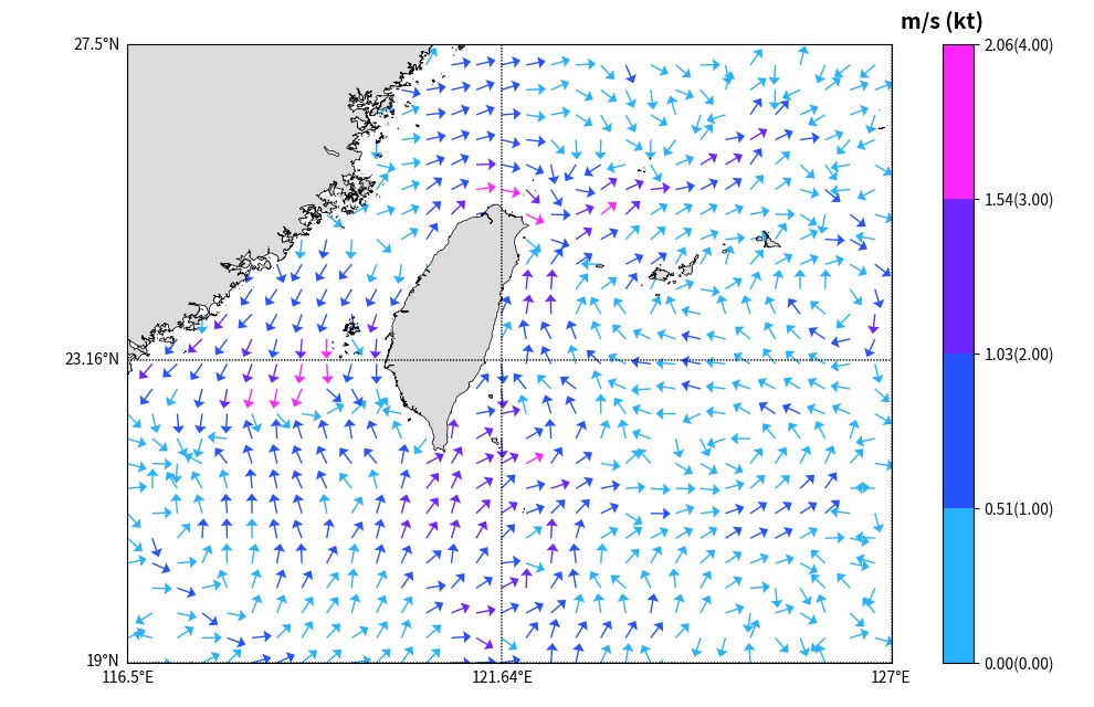
The SCHISM-predicted hydrodynamic phenomena around Taiwan include various types of horizontal and vertical oceanic flows. Figures 1 and 2 respectively show the current variations during flood and ebb tides. In the figures, the arrows indicate the direction of current flow, while the arrow colors represent current velocity. In the Taiwan Strait, the current direction is reversed between flood and ebb tides: during flood tide, currents flow into the strait from both the northeast and southwest corners, converging approximately between the Taichung and Hsinchu offshore areas; during ebb tide, the current flows outward from the same area toward the northeast and southwest corners of the strait. Additionally, along Taiwan’s eastern coast, the Kuroshio Current can be observed flowing northward continuously during both flood and ebb tides. The current data predicted by SCHISM can be applied to the aforementioned fields, contributing to the protection and sustainable management of Taiwan’s marine environment.
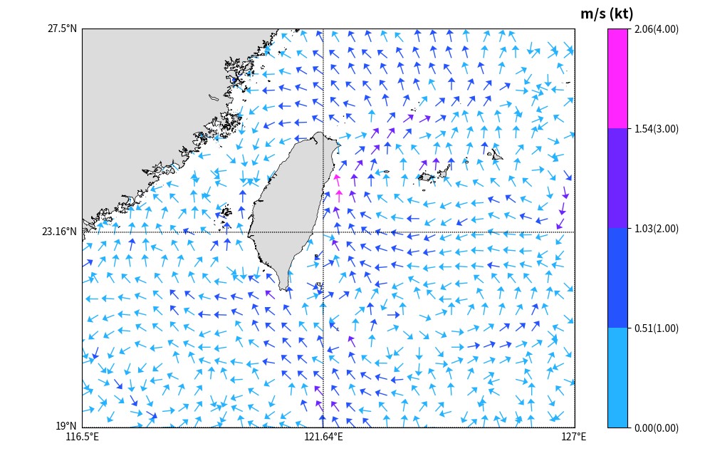
Figure 1. SCHISM-simulated ocean current patterns around Taiwan during flood tide